Pick out your stop
Kings Canyon size, geology and the Lost City domes
Browse 14 stops
Kings Canyon, the stays around it and the roads in
Choose a route, then tap a pin or stop for its note and a Google Maps link.
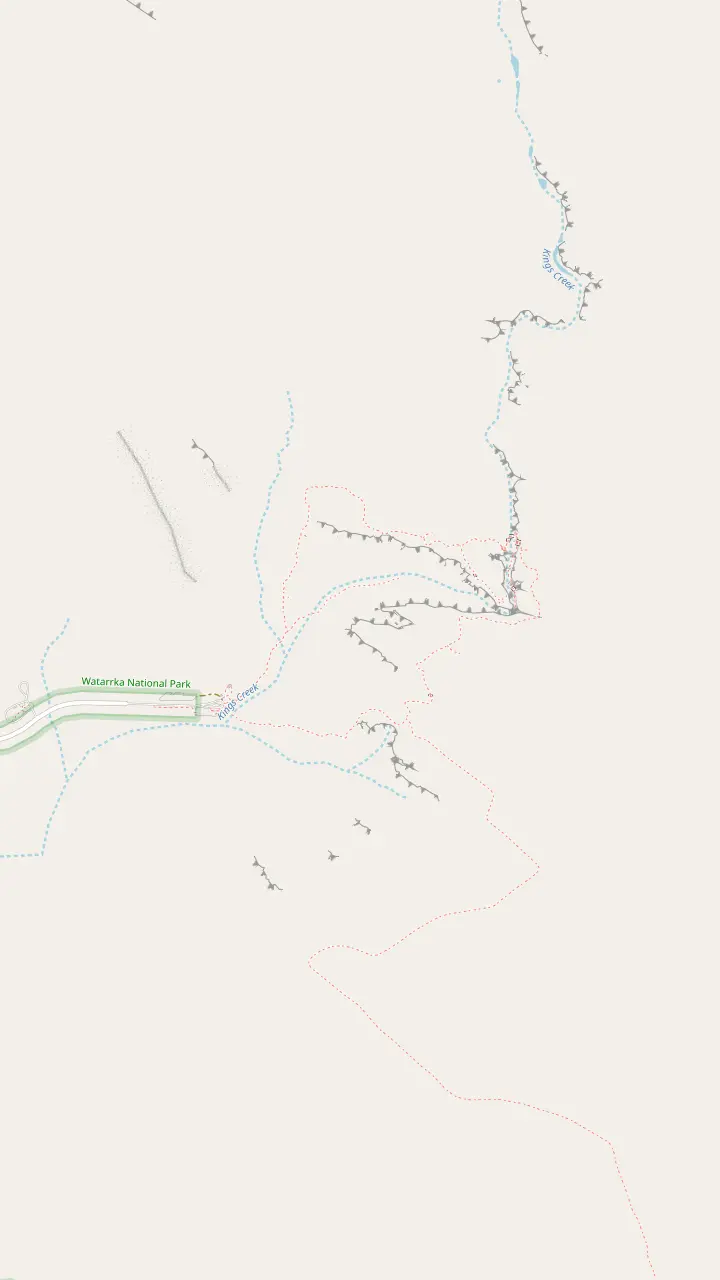
The car park is the trail head for most walks in the area, and the routes are colour coded.
Google MapsThe creek walk ends at a raised platform with a lookout and takes around 1 hour.
Google MapsA permanent waterhole shaded by exotic plants. It is a sacred spot for the Traditional Owners, so do not swim.
Google MapsOn the Rim Walk, the climb is followed by views from Cotterill's Lookout.
Google Maps
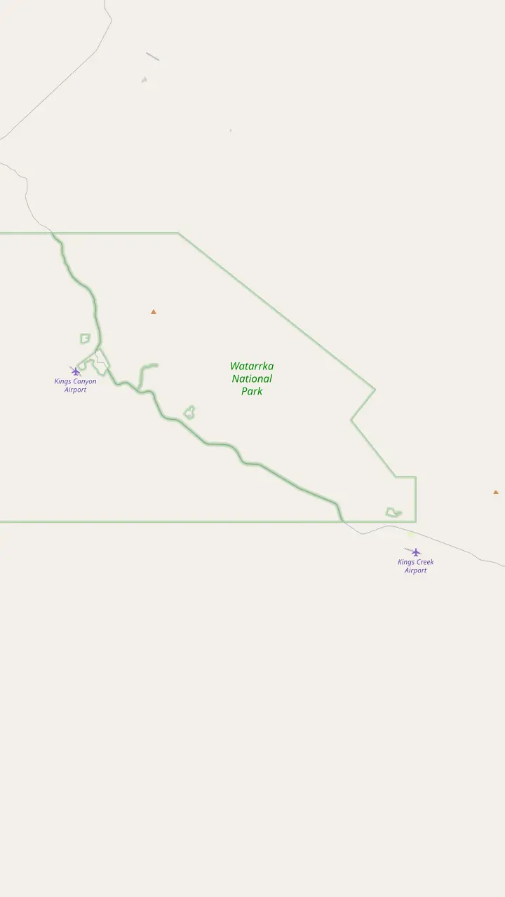
The resort has a swimming pool, tennis court, BBQ, laundry room and petrol station.
Google MapsThe resort lies 10 km from this car park and 7 km from the park entrance.
Google MapsA Grade 1 walk of 2.5 km return, very flat and wheelchair accessible.
Google MapsThe station lies 36 km from Kings Canyon and is closed from 1 November 2026 until 1 March 2027.
Google Maps
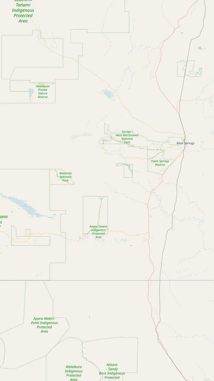
Kings Canyon is about 450 km south west of Alice Springs.
Google MapsMereenie Loop permits can be bought at the Hermannsburg General Store.
Google MapsFuel and limited supplies are sold at Glen Helen, Hermannsburg, Kings Creek Station and Kings Canyon Resort.
Google MapsThe unsealed Mereenie Loop ends here, between Kings Canyon Resort and the Larapinta Drive junction.
Google MapsCurtin Springs Station is a working cattle station and roadhouse on the Lasseter Highway.
Google MapsWatarrka National Park is only 3 hours' drive from Uluru.
Google Maps
Mapping data © OpenStreetMap contributors
A guide to the scale of the canyon, the sandstone it is cut from, the domes called the Lost City and the people whose land it is. Numbers come from park and tourism boards, with each source named.
Editorial team, kingscanyontour.com · Updated November 7, 2026 · ~7 min read
Main facts
- WallsThe sandstone walls are 100 m high, with palm-filled crevices.1
- CliffsCliffs now stand over 100 to 150 m tall after long erosion.2
- Age of rockThe canyon dates back beyond 440 million years.3
- Lost CitySandstone domes that resemble an ancient walled city.4
- ParkWatarrka National Park covers over 70,000 hectares.5
How big Kings Canyon is
Kings Canyon size is easiest to grasp in a few numbers, since it is a gorge cut into sandstone. Tourism NT describes sandstone walls 100 m high, crevices filled with palms and views over the desert.1 Tourism Central Australia puts the cliffs at over 100 to 150 m tall, shaped by millions of years of water, wind and sand erosion.2 These figures are close but not identical, so read both as a guide to the scale rather than as a survey.
The canyon sits inside a much larger park. Watarrka National Park covers over 70,000 hectares, and the canyon sits inside it.5 A well-known way to take the canyon's measure is the Rim Walk, a loop of 6 km that usually takes around 3 to 4 hours and is graded moderate to difficult, Grade 4.6 The route opens with a climb of some 500 steep steps before it reaches the top.7
For a sense of position, Kings Canyon is about 300 km north east of Uluru and about 450 km south west of Alice Springs.8 Watarrka National Park is only 3 hours' drive from Uluru, which puts it within reach of a day trip.9 The table and chart below place the canyon beside Uluru and Kata Tjuta, so you can compare how each rock is built and how tall it stands.
Three rocks
Kings Canyon, Uluru and Kata Tjuta compared
| Place | Shape | Size | Age |
|---|---|---|---|
| Kings Canyon | A gorge in sandstone1 | Cliffs over 100 to 150 m2 | Beyond 440 million years3 |
| Uluru | A monolith of arkose sandstone16 | 348 m above the plain15 | About 550 million years17 |
| Kata Tjuta | 36 dome-shaped rocks14 | Up to 546 m above the ground14 | Not compared here |
Sizes are the boards' own figures for different measures, so the table compares character and not height alone.
How the sandstone formed
The story of the canyon walls begins deep in time, long before any path crossed the plateau. Tourism Central Australia reports that Kings Canyon dates back beyond 440 million years, to when its lower layers of Carmichael sandstone were first deposited.3 The layers are the foundation of everything you see on the rim, and the rest of the story is a matter of what removed the rock above them.
Geologists estimate that about 40 million years after the lower layers were laid down, the valley began to take shape as it cut down through a softer sandstone layer lying above.10 Water, wind and sand did the work over millions of years, and they produced the cliffs, gullies and rock carvings visible today.2 The result is a deep cut with a green floor, which Professional Helicopter Services describes as a chasm of sheer sandstone cliffs and ancient cycads.13
These figures are estimates from a regional tourism board, and geologists revise them. Treat the dates as estimates, a way of feeling the scale rather than exact ages, and expect other sources to word them differently. The shape of the canyon, a gorge with vertical walls over a creek, is a safer fact than any date, and you can see it from the rim, from the floor or from a helicopter.
The Lost City domes
Seen from the top of Kings Canyon, the domes are grouped under the name Lost City, a nod to their likeness to an old walled city.4 The trail runs through a stretch of them, so walkers on the rim get close to the weathered shapes and can judge their size against a person standing beside them.4 The domes sit on the plateau above the gorge, and they reward a slow pace and a steady camera hand.
The Rim Walk offers views from Cotterill's Lookout once the climb is done, and the trail then reaches the domes before the descent to the Garden of Eden.22,23 Keep to the marked path and the colour-coded arrows, because the walks are well marked and the car park is the trail head for most of them.24 The domes are not a place to wander off the track.
From the air, the picture changes. The 15-minute helicopter flight takes in the canyon, the Garden of Eden, the Lost City's weathered domes and the flat-topped Carmichael Crag.19 The matching listing, rated 4.8 from 93 reviews, is listed from $140. A flight and a walk show the same domes at different scales, and the helicopter page covers the detail.
Match your interest
What to look for at Kings Canyon
Choose what draws you and see where to find it
If I like rocks and landforms
The Lost City domes
They resemble an ancient walled city, and a section of the trail runs between them.4
If I like water and plants
The Garden of Eden
It is a permanent waterhole shaded by exotic plants.18
If I want the big picture
A helicopter flight
The 15-minute flight takes in the canyon, garden, domes and Carmichael Crag.19
If I want the people and culture
The Karrke experience
It is a 1-hour tour with a short walk about food, medicine and art.20
If I want an expert beside me
A ranger walk
Ranger walks are possible on some tracks, particularly the Rim Walk.21
The Garden of Eden and the life in the gorge
The green floor of the gorge comes into view at the waterhole. The Garden of Eden is a permanent waterhole shaded by some exotic plants.18 Tourism NT places it about halfway round the Rim Walk and describes a rockhole surrounded by rare plant life.38 Tourism NT also gives palm-filled crevices as part of the canyon scene.1 Seen from the rim, that line of palms and plants stands out against the red rock, and it makes the floor look like a hidden garden of its own.
The park is a conservation area, and more than 600 native plant and animal species shelter there.39 Ancient cycads grow in the chasm, according to the helicopter operator's description.13 The longer helicopter flight crosses Petermann Pound, where wild camels and brumbies may be seen, so the wildlife story continues beyond the gorge itself.40 On foot, bring binoculars and sit quietly for a few minutes at a lookout, as you will notice more birds and movement than you do while walking.
The waterhole is not for swimming, and that is a rule worth following. It is a sacred spot for the Traditional Owners, and the guidance is not to swim or disrespect the place.26 Tourism NT states plainly that swimming is not permitted.41 There are no natural waterholes for swimming at Kings Canyon at all, and the resort and the station each have a pool for cooling off.42,43
Deep time
From deposit to canyon, in the order it happened
Beyond 440 million
Lower layers laid down
The lower Carmichael sandstone layers were first deposited.3
About 40 million later
The valley begins
The gorge began to cut down through softer sandstone higher in the rock.10
Millions of years
Water, wind and sand
Erosion produced the cliffs, gullies and rock carvings seen today.2
Over 20,000 years
People on the land
The Luritja people have called the park area home for more than 20,000 years.11
1872
Kings Creek named
Explorer Ernest Giles named Kings Creek after his friend Mr Fielder King.12
Today
A national park
Watarrka National Park covers over 70,000 hectares.5
What is Kings Canyon famous for?
Ask what Kings Canyon is famous for, and the answer comes in layers, depending on whether you ask a walker, a photographer or a geologist. It is known for the sandstone walls that rise 100 m from the creek, for the rim route that circles the top, for the domes called the Lost City and for the green rockhole of the Garden of Eden.1,6,4,38 The views from the top stretch across the desert.1
Evening has its own attraction. The Sunset Viewing Platform is at Discovery Resorts Kings Canyon, where the sun sets behind Carmichael's Crag.44 It is a place to sit quietly after a day on the trail and watch the colour leave the escarpment. The walks add variety, from a gentle trail on the floor to the full rim loop.45,6 Watarrka has walking trails, 4x4 tracks, camel tours and accommodation from camping to resort-style rooms.46 Put together, those pieces explain why a visit here can fill a day or stretch to a long weekend.
The canyon is a companion to Uluru in the sense that both are Red Centre sandstone, though they differ in form. Uluru rises 348 m above the surrounding plain and began forming about 550 million years ago,15,17 and Kata Tjuta is a formation of 36 dome-shaped rocks that rises to 546 m above the ground.14 Kings Canyon is a cut in the land and not a monolith, so walkers look down into it as much as up.
Video
Kings Canyon and its 400 million years of rock
OzGeology on YouTube · The clip loads only after you tap play.
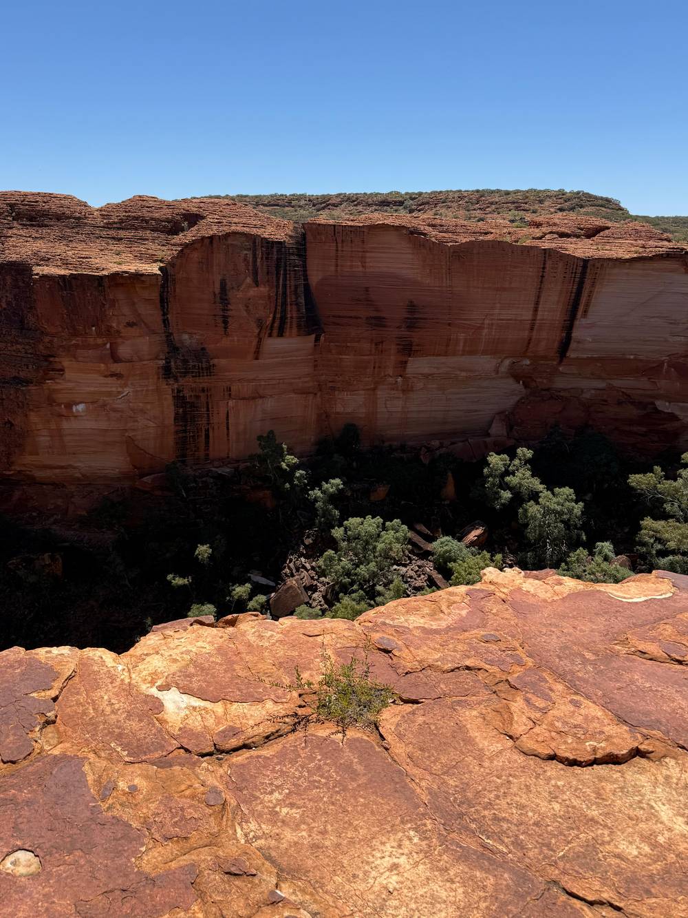
The sandstone domes are collectively known as the Lost City as they resemble an ancient walled city.
On the rim
A checklist for seeing the geology
Look for3
Watarrka, the people and the Aboriginal cultural tour
Kings Canyon is part of the land the Luritja and Arrente people call Watarrka, which is where the national park gets its name.47 The park lies on Luritja and Arrente country, and the Traditional Owners manage it together with the Northern Territory government.48 The Luritja have lived in the area now protected as Watarrka National Park for more than 20,000 years.11
European names came later. Explorer Ernest Giles named Kings Creek in 1872 after his friend Mr Fielder King, and the canyon takes its English name from the creek.12 For an Aboriginal cultural tour of Kings Canyon, the Karrke Aboriginal Cultural Experience is a 1-hour tour with a short walk that teaches about the food, medicine and art of the Luritja and Pertame people.20 The experience was established in 2014.49
A ranger can add a further layer. On some tracks in Watarrka National Park, particularly the Rim Walk, it is possible to walk with a ranger, and a ranger can explain the cultural significance of specific sites.21 Listen for names and respect the places that are sacred, including the Garden of Eden, where visitors should not swim.26 The stories attached to the rock matter as much as the geology.
FAQ
Short questions, short answers.
How big is Kings Canyon?
How old is Kings Canyon?
What are the Lost City domes?
They are collectively known as the Lost City because they resemble an ancient walled city.4
How big is Watarrka National Park?
Watarrka National Park covers over 70,000 hectares.5
What does Watarrka mean?
The Luritja and Arrente people call the land that Kings Canyon is part of Watarrka, which gave the park its name.47
Who named Kings Creek?
Giles named it after his friend Mr Fielder King.12
Is there an Aboriginal cultural tour?
It is a 1-hour tour with a short walk about food, medicine and art, led for the Luritja and Pertame people.20
Sources
- Tourism NT · Kings Canyon and Watarrka National Park ↩
- Tourism Central Australia · A dive into the geological history of the Red Centre ↩
- Tourism Central Australia · A dive into the geological history of the Red Centre ↩
- Tourism Central Australia · Kings Canyon hikes and walks ↩
- Tourism Central Australia · Kings Canyon hikes and walks ↩
- Tourism NT · Kings Canyon Rim Walk ↩
- Tourism Central Australia · Kings Canyon hikes and walks ↩
- Tourism Central Australia · Kings Canyon region guide ↩
- Tourism NT · Kings Canyon and Watarrka National Park ↩
- Tourism Central Australia · A dive into the geological history of the Red Centre ↩
- Tourism Central Australia · Kings Canyon region guide ↩
- Tourism Central Australia · Kings Canyon region guide ↩
- Professional Helicopter Services · Kings Canyon helicopter scenic flights ↩
- Tourism Central Australia · A dive into the geological history of the Red Centre ↩
- Parks Australia, Uluṟu-Kata Tjuṯa National Park · Amazing facts ↩
- Tourism Central Australia · A dive into the geological history of the Red Centre ↩
- Parks Australia, Uluṟu-Kata Tjuṯa National Park · Geology ↩
- Tourism Central Australia · Kings Canyon hikes and walks ↩
- Professional Helicopter Services · Kings Canyon helicopter scenic flights ↩
- Tourism Central Australia · Things to do in Kings Canyon ↩
- Tourism Central Australia · Things to do in Kings Canyon ↩
- Tourism Central Australia · Kings Canyon hikes and walks ↩
- Tourism Central Australia · Kings Canyon hikes and walks ↩
- Tourism Central Australia · Kings Canyon hikes and walks ↩
- Tourism Central Australia · Kings Canyon hikes and walks
- Tourism Central Australia · Kings Canyon hikes and walks ↩
- Discovery Resorts · Kings Canyon
- Tourism Central Australia · Kings Canyon hikes and walks
- Tourism Central Australia · Kings Canyon hikes and walks
- Kings Creek Station · Accommodation
- Kings Creek Station · Welcome to Kings Creek Station
- Tourism Central Australia · Kings Canyon dining
- Discovery Resorts · Kings Canyon
- Tourism Central Australia · Permits
- Tourism Central Australia · The Mereenie Loop
- Tourism Central Australia · Permits
- Tourism NT · The Red Centre Way in 6 days
- Tourism NT · Kings Canyon Rim Walk ↩
- Tourism Central Australia · Kings Canyon region guide ↩
- Tourism NT · Kings Canyon scenic helicopter tours ↩
- Tourism NT · Kings Canyon Rim Walk ↩
- Tourism Central Australia · Kings Canyon region guide ↩
- Tourism Central Australia · Kings Canyon region guide ↩
- Tourism Central Australia · Things to do in Kings Canyon ↩
- Tourism NT · Kings Creek Walk ↩
- Tourism NT · Kings Canyon and Watarrka National Park ↩
- Tourism Central Australia · Kings Canyon region guide ↩
- Tourism Central Australia · Kings Canyon hikes and walks ↩
- Karrke Aboriginal Cultural Experience · Aboriginal Cultural Experience & Tours ↩
Related reading